


Voting District 140, Craig County, Oklahoma
About
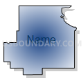
Outline

Summary
| Unique Area Identifier | 653860 |
| Name | Voting District 140 |
| County | Craig County |
| State | Oklahoma |
| Area (square miles) | 90.92 |
| Land Area (square miles) | 90.63 |
| Water Area (square miles) | 0.29 |
| % of Land Area | 99.68 |
| % of Water Area | 0.32 |
| Latitude of the Internal Point | 36.92168690 |
| Longtitude of the Internal Point | -95.09175910 |
Maps


Graphs
Select a template below for downloading or customizing gragh for Voting District 140, Craig County, Oklahoma


Neighbors
Neighoring Voting District (by Name) Neighboring Voting District on the Map
- Voting District 13, Ottawa County, OK
- Voting District 130, Craig County, OK
- Voting District 30, Ottawa County, OK
- Voting District 410, Craig County, OK
- Voting District 9, Ottawa County, OK
- Neosho Township Melrose Voting District, Cherokee County, KS
- Richland Township Voting District, Labette County, KS
Top 10 Neighboring County Subdivision (by Population) Neighboring County Subdivision on the Map
- Miami CCD, Ottawa County, OK (20,133)
- Picher-Peoria CCD, Ottawa County, OK (4,150)
- North Craig CCD, Craig County, OK (3,061)
- Richland township, Labette County, KS (287)
- Neosho township, Cherokee County, KS (279)
Top 10 Neighboring Place (by Population) Neighboring Place on the Map
Top 10 Neighboring Unified School District (by Population) Neighboring Unified School District on the Map
- Miami Public Schools, OK (15,278)
- Columbus Unified School District 493, KS (7,571)
- Commerce Public Schools, OK (4,088)
- Chetopa-St. Paul Unified School District 505, KS (2,652)
- Welch Public Schools, OK (1,882)
- Bluejacket Public Schools, OK (1,531)
Top 10 Neighboring State Legislative District Lower Chamber (by Population) Neighboring State Legislative District Lower Chamber on the Map
- State House District 6, OK (35,997)
- State House District 7, OK (33,272)
- State House District 1, KS (20,329)
- State House District 7, KS (19,922)
Top 10 Neighboring State Legislative District Upper Chamber (by Population) Neighboring State Legislative District Upper Chamber on the Map
- State Senate District 1, OK (75,819)
- State Senate District 29, OK (74,057)
- State Senate District 14, KS (61,993)
Top 10 Neighboring 111th Congressional District (by Population) Neighboring 111th Congressional District on the Map
Top 10 Neighboring Census Tract (by Population) Neighboring Census Tract on the Map
- Census Tract 5747, Ottawa County, OK (4,573)
- Census Tract 5741, Ottawa County, OK (4,150)
- Census Tract 3731, Craig County, OK (3,061)
- Census Tract 9582, Cherokee County, KS (2,328)
- Census Tract 9506, Labette County, KS (2,296)
- Census Tract 9508, Labette County, KS (1,357)